- 19, Jan 2026 | Khilak Budhathoki
The Annapurna Himalaya is one of Nepal’s most distinctive mountain regions, stretching across north-central Nepal and encompassing the Annapurna massif, the Annapurna Conservation Area, and a remarkable range of Himalayan landscapes. The region is defined by major peaks including Annapurna I (8,091m), Annapurna II (7,937m), Annapurna III (7,555m), Annapurna IV (7,525m), Gangapurna (7,455m), and Annapurna South (7,219m), alongside the iconic Machhapuchhre (6,993m). From the subtropical valleys and terraced farmland around Pokhara to rhododendron forests, alpine meadows, high-altitude desert, glacial terrain, and the Kali Gandaki Valley, the Annapurna Himalaya contains dramatic elevation and climate transitions within a relatively compact area. Its protected 7,629-square-kilometer landscape also supports diverse Himalayan ecosystems and communities shaped by Gurung, Thakali, Manangi, and Tibetan-influenced cultures.
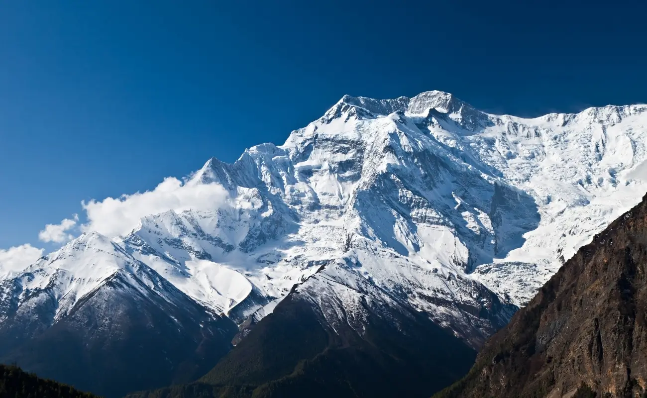
Annapurna trekking is the main way travelers experience this mountain region, with routes ranging from short, accessible journeys to demanding high-altitude crossings. The Annapurna Circuit crosses the 5,416-meter Thorong La Pass, the Annapurna Base Camp Trek reaches 4,130 meters within the Annapurna Sanctuary, Mardi Himal follows a high ridge toward 4,500 meters, and the Ghorepani Poon Hill Trek offers a lower-altitude introduction to Himalayan scenery. Trekking conditions vary significantly by elevation and season, making route selection, acclimatization, weather awareness, permits, appropriate gear, and physical preparation essential. This guide explores the Annapurna Himalaya in detail, covering its geography, major peaks, trekking routes, landscapes, cultures, seasons, difficulty levels, altitude challenges, permits, safety considerations, and practical preparation for exploring the region.
Where Is the Annapurna Himalaya Located in Nepal?
The Annapurna Himalaya is located in north-central Nepal within Gandaki Province, approximately 200 kilometers west of Kathmandu. Pokhara, the primary gateway city, sits just 40 kilometers south of the range at an elevation of 822 meters above sea level.
The range extends roughly 55 kilometers from east to west. The Tibetan Plateau borders it to the north. The Pokhara Valley sits to the south. The Kali Gandaki Gorge, running along the western edge, is the deepest river gorge on earth, reaching over 5,500 meters in depth measured from the riverbed to the summit of Dhaulagiri. This is not a frequently cited number, and most trekkers walk through it without knowing.
Most Annapurna trekking routes start from Pokhara or from road-connected trailheads including Besisahar, Nayapul, and Siwai. Direct flights connect Kathmandu to Pokhara in 25 minutes. The drive takes 6 to 7 hours via the Prithvi Highway.
What Makes the Annapurna Mountain Range Geographically Significant?
The Annapurna range concentrates 4 of Nepal's 14 eight-thousanders within a geographic zone of roughly 55 kilometers, making it one of the densest clusters of high-altitude peaks on the planet. The range demonstrates a 7,000-meter elevation gain over a horizontal distance of just 50 kilometers, one of the world's most compressed altitude gradients.
This gradient drives everything. Within a single trek, you cross subtropical forest, temperate rhododendron forest, alpine meadow, and glacial moraine. The Annapurna Himalaya sits at the collision zone of two distinct climate systems: the Indian monsoon from the south and the Tibetan steppe climate from the north. That collision produces the Annapurna region's biodiversity numbers, which genuinely stand out even by Himalayan standards.
The Annapurna Conservation Area, established in 1986, protects 7,629 square kilometers and contains over 100 species of mammals, 478 species of birds, and more than 1,000 plant species. This protected status shapes trekking infrastructure, permit systems, and the sustainable teahouse model that makes logistics in this region function as smoothly as they do.
Which Major Peaks Are Found in the Annapurna Himalaya?
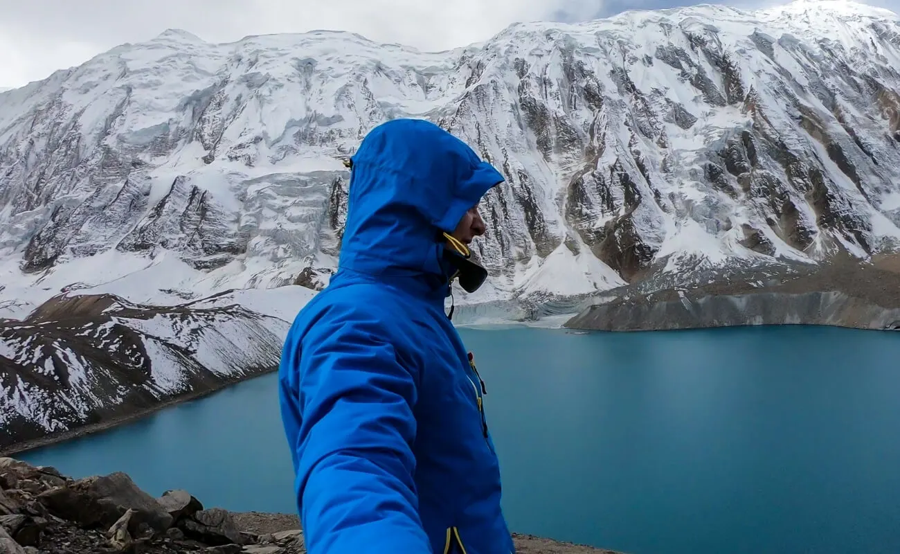
The Annapurna Himalaya contains numerous peaks above 7,000 meters, with the most prominent being Annapurna I (8,091m), Annapurna II (7,937m), Annapurna III (7,555m), Annapurna IV (7,525m), Gangapurna (7,455m), and Annapurna South (7,219m). The iconic Machhapuchhre sits just below this mark at 6,993m.
Annapurna I holds a specific and sobering distinction: it carries the highest fatality-to-summit ratio of any 8,000-meter peak, with a historical death rate near 32%. It was first summited on June 3, 1950, by French climbers Maurice Herzog and Louis Lachenal, making it the first 8,000-meter peak ever climbed. That fact tends to surprise people who assume Everest was first.
Machhapuchhre, also called Fishtail Mountain, sits at 6,993 meters and is visible from Pokhara and from most Annapurna trekking routes. The Nepal government declared it a sacred, unclimbable mountain in 1957, no permit has been issued to summit it since. Its distinctive twin-peaked silhouette is one of the most recognized shapes in the Himalayas.
Gangapurna at 7,455 meters forms the dramatic north wall above Manang village on the Annapurna Circuit. Most trekkers stare at it for two days in Manang without knowing its name. The glacier it produces feeds Gangapurna Lake below the village and is visible from teahouse rooftops at 3,519 meters.
Why Is the Annapurna Region Famous for Trekking?
The Annapurna region receives more trekkers annually than any other mountain area in Nepal. In 2023, the Annapurna Conservation Area registered 135,142 trekking permits, approximately 44% of all trekking permits issued across Nepal in that year.
Three specific factors drive that number: route diversity, cultural access, and teahouse infrastructure. No other trekking region in Nepal offers four completely distinct multi-day routes that suit beginner through experienced trekkers within the same conservation area. Teahouses and lodges exist at nearly every stop on all major routes, eliminating the need for camping equipment on most itineraries.
Pokhara is the third factor people underestimate. Having a lakeside city with international restaurants, certified gear shops, and reliable domestic flight connectivity just 40 kilometers from the trailhead removes most of the logistical complexity that makes Everest-region trekking harder to arrange. Arriving in Pokhara one day and starting a trek the next morning is a realistic plan.
What Makes Annapurna Trekking Different From Other Nepal Treks?
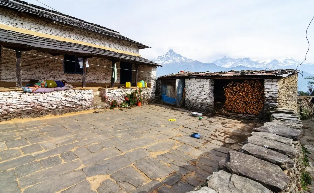
Annapurna trekking differs from other Nepal treks in three ways that matter to real trekkers: faster elevation transition, more cultural variety per route, and better road connectivity. The Annapurna Circuit passes through five distinct ethno-cultural zones in a single loop, something no other established route in Nepal achieves at that scale.
On Everest-region treks, one dominant culture (Sherpa) runs throughout most of the route. On the Annapurna Circuit, you pass through Gurung, Thakali, Manangi, and Tibetan-influenced Bhotia communities within the same 14 to 21-day itinerary. Each zone has distinct architecture, food traditions, religious practices, and centuries-old trade histories.
Landscape diversity is the other factor. The circuit covers 160 to 230 kilometers depending on entry and exit points, crossing terrain that shifts from rice paddy terraces and subtropical riverbanks to pine forests, wind-scoured high desert, and glaciated pass crossings. The Annapurna Base Camp Trek compresses significant variation into 7 to 12 days, finishing at a natural glacial amphitheater ringed by three 8,000-meter peaks, a setting with no equivalent on any other Nepal trekking route.
Which Landscapes Can You Experience on an Annapurna Trek?
An Annapurna trek passes through six distinct landscape types in sequence: subtropical lowlands, broadleaf forest, rhododendron forest, alpine meadows, high-altitude steppe, and glacial moraine. The transition between each zone is gradual enough to feel immersive and fast enough to register clearly within a few days.
Starting from Pokhara or Nayapul, treks begin in warm foothills with terraced rice and millet fields, stone-walled villages, and river crossings over the Modi Khola or Marsyangdi. By 2,500 meters, vegetation shifts to mixed oak and rhododendron forest. March and April trekkers walk through tunnels of blooming rhododendrons in red, pink, and white, Nepal's national flower reaches its highest density in this elevation band.
Above 3,000 meters, forests thin into high grasslands and juniper scrub. On the circuit's northern sections beyond Manang, the landscape turns austere: brown rock, blue sky, prayer flag lines, and almost no vegetation. This is the rain shadow produced by the Annapurna and Dhaulagiri massifs blocking monsoon moisture. The contrast between the lush southern valleys and the dry northern plateau is jarring in the best possible way.
At Annapurna Base Camp (4,130m), the landscape closes into a glacial cirque. On three sides, walls of ice and rock rise 4,000 meters above the camp. Local guides call the early morning light on Annapurna I's summit "the fire." It's not a metaphor they invented for trekkers, it's just what it looks like.
What Cultural Experiences Can You Expect Along the Trails?
Annapurna trekking exposes you to four distinct ethnic communities: Gurung, Thakali, Manangi, and Tibetan-influenced Bhotia. Each community has occupied a different elevation zone in this region for over 1,000 years, and daily life in many villages still reflects those patterns.
Gurung villages like Ghandruk (1,940m) and Chhomrong (2,170m) feature stone-paved paths and traditional flat-roofed architecture. Ghandruk has a Gurung Museum that documents migration patterns, traditional weaving, and local history, small, but worth the hour it takes to walk through.
Thakali villages cluster along the Kali Gandaki Valley near Tatopani and Jomsom. The Thakali are historically Nepal's most accomplished merchant traders, having controlled the Mustang salt route for centuries. Thakali guesthouses are widely regarded as the best-run teahouses in Nepal, a reputation they've held since trekking tourism began in this region in the 1970s.
The Manang district contains Manangi communities who historically held unique trading privileges, including customs duty exemptions granted by royal decree in 1784. Walking through Manang and Upper Pisang, you'll see Tibetan-style gompas, mani walls, and prayer wheels that reflect centuries of Tibetan Buddhist influence in this valley.
At teahouses across all Annapurna routes, you will eat dal bhat, lentil soup, rice, and seasonal vegetables. Many lodges in the region offer unlimited refills. This is a long-standing teahouse tradition that every trekker discovers with genuine appreciation somewhere around day four.
Which Are the Most Popular Annapurna Trekking Routes?
The four most popular Annapurna trekking routes are: Annapurna Circuit Trek, Annapurna Base Camp Trek, Mardi Himal Trek, and Ghorepani Poon Hill Trek. Each suits a different combination of duration, available days, fitness level, and altitude preference.
1. Annapurna Circuit Trek
The Annapurna Circuit Trek is a 160 to 230-kilometer loop that circumnavigates the entire Annapurna massif, crossing Thorong La Pass (5,416m) at its highest point. Standard itineraries run 14 to 21 days, depending on acclimatization needs and optional side trips to destinations like Tilicho Lake (4,949m) or Nar Phu Valley.
The route starts from Besisahar or Bhulbhule, follows the Marsyangdi River upstream through Chame, Pisang, and Manang, crosses Thorong La at 5,416 meters, then descends through Muktinath, Jomsom, and the Kali Gandaki Valley before exiting at Nayapul or continuing to Pokhara via Ghorepani. The Thorong La crossing is the defining moment of the trek, an early start from High Camp at 3:30 to 4:00 AM, 4 to 6 hours of climbing in cold and wind, followed by a long descent to Muktinath.
Road construction has changed parts of this trek. A jeep road now runs parallel to sections of the eastern and northern route, meaning walkers on those sections occasionally share the path with vehicle traffic. The southern section from Tatopani to Nayapul remains road-free and holds the most intact trekking character on the route.
2. Annapurna Base Camp Trek
The Annapurna Base Camp Trek covers 110 to 115 kilometers over 7 to 12 days, finishing at Annapurna Base Camp at 4,130 meters inside a glacial cirque surrounded by Annapurna I, Annapurna South, and Machhapuchhre.
The route starts from Nayapul or Phedi, passes through Ghandruk and Chhomrong, then enters the Modi Khola gorge, following the river upstream through bamboo forest and rhododendron groves to base camp. The gorge section is narrow, forested, and noticeably different in feel from the open ridge walking of the Poon Hill or Circuit routes.
Chhomrong (2,170m) is the last reliable supply point before the gorge. Above it, the route enters a canyon where avalanche risk increases in winter months. Most trekking agencies avoid base camp itineraries in January and February for this reason. The base camp itself sits in what French climbers named "the Sanctuary" in 1950, a glacial amphitheater where the 360-degree view includes five major Himalayan peaks from a single standing point.
3. Mardi Himal Trek
The Mardi Himal Trek is a 5 to 9-day route reaching Mardi Himal Base Camp at 4,500 meters via a ridge trail above the Modi Khola valley, accessible from Pokhara through Kande or Dhampus. It is the least crowded of the four major Annapurna routes, receiving roughly seven to eight times fewer trekkers than the Annapurna Base Camp trail.
The trail runs along a high ridge between the Modi and Mardi Khola valleys, providing continuous Himalayan views from day two onward. Machhapuchhre appears at close range from High Camp (4,500m), many trekkers report it looks bigger from here than from Annapurna Base Camp, which sits further away from the peak.
Teahouse infrastructure on the Mardi route has developed significantly since 2012, when Nepal Tourism Board formalized it as an established trekking route. Most lodges here are small and family-run, with limited rooms, booking ahead matters in October and November in ways it does not on the busier ABC approach.
4. Ghorepani Poon Hill Trek
The Ghorepani Poon Hill Trek is a 4 to 6-day route reaching Poon Hill viewpoint (3,210m) above Ghorepani village (2,874m). It is the most accessible major trek in Nepal for first-time trekkers, with a maximum elevation of 3,210 meters and well-maintained lodge facilities at every stop.
The route starts from Nayapul, passes through Ulleri and Ghorepani, climbs Poon Hill for sunrise, then descends through Tadapani and Ghandruk back to Nayapul. The pre-dawn climb from Ghorepani to Poon Hill takes 30 minutes on a well-marked path and delivers a 270-degree panorama of Dhaulagiri (8,167m), the Annapurna range, and Machhapuchhre at first light.
This route is the right starting point for trekkers with no Himalayan experience, limited time, or children above ten years old. Maximum altitude stays low enough that acute mountain sickness is rarely a significant concern at 3,210 meters.
When Is the Best Time to Trek in the Annapurna Himalaya?
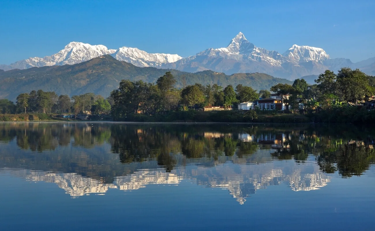
The best time to trek in the Annapurna Himalaya is October through November and March through April. These two windows offer clear skies, stable temperatures, and good trail conditions across all elevation ranges. They correspond to Nepal's post-monsoon and pre-monsoon seasons.
Which Seasons Offer the Best Annapurna Trekking Conditions?
The Annapurna region has four trekking seasons: autumn (October to November), spring (March to April), winter (December to February), and monsoon (June to September). Autumn and spring are primary seasons. Winter and monsoon are secondary, each with specific limitations.
-
Autumn is the most popular window. Post-monsoon air is freshly cleared and produces the sharpest mountain views of the year. October temperatures at Annapurna Base Camp range from -2°C to 10°C during the day, while lower trail sections remain warm and comfortable.
-
Spring is the second-best window and arguably more visually striking below 3,500 meters because of rhododendron blooms. Views can be slightly less sharp than autumn due to haze and afternoon cloud buildup, but the flowering forests on the Chhomrong approach and between Ulleri and Ghorepani make spring the preferred season for photography.
-
Winter is viable for low-altitude routes like Ghorepani Poon Hill and the lower ABC trail sections. The Thorong La Pass and upper base camp routes become seriously cold. Thorong La sees temperatures below -20°C in January and wind exposure that makes the crossing uncomfortable and sometimes dangerous.
-
Monsoon is avoidable for most trekkers. Cloud cover blocks mountain views on the majority of days, trails become slippery, and leeches appear on the lower jungle sections. The upper Manang sections of the circuit fall in the rain shadow and stay relatively dry, some experienced trekkers specifically target this section in monsoon for the dramatically empty trail.
What Is the Weather Like Across the Annapurna Region?
Weather in the Annapurna region varies by elevation and north-south position. Pokhara on the southern side averages 3,900mm of annual rainfall, one of the wettest cities in Asia. The Manang valley on the northern side receives under 300mm annually due to the Himalayan rain shadow.
In October, daytime temperatures at Pokhara reach 28°C. At Thorong High Camp (5,100m), they drop to -10°C at night. That 38-degree spread across one trek is the most practical packing challenge for most trekkers, you need a clothing system that covers the entire range.
Wind on exposed ridges above 4,000 meters is the least-discussed weather variable. On Poon Hill, Thorong La, and the upper Annapurna Base Camp approach, early morning wind makes the effective temperature 10 to 15 degrees colder than the air temperature reading. Wind-blocking outer layers matter more than most packing guides acknowledge.
What Should You Know About Annapurna Trekking Difficulty?
Annapurna trekking difficulty ranges from easy on the Ghorepani Poon Hill route to strenuous on the Annapurna Circuit Thorong La crossing. The four key factors that determine difficulty are maximum altitude, daily elevation gain, total distance, and technical terrain.
How Difficult Is the Annapurna Circuit Trek?
The Annapurna Circuit Trek rates as moderate to strenuous. The Thorong La crossing requires ascending 1,100 meters over 4 to 6 hours from High Camp (4,925m) to the pass summit (5,416m), then descending 1,600 meters to Muktinath (3,760m) on the same day.
Daily trekking time averages 5 to 8 hours at a medium pace. Elevation gains rarely exceed 900 meters per day on the standard itinerary. Good cardiovascular fitness matters more than technical climbing skills, there are no ropes, ladders, or technical sections on the circuit. What breaks trekkers is cumulative fatigue across 14-plus days, not any single day's challenge.
The most common strategic mistake on this trek is spending only one night in Manang instead of two. The Manang valley (3,500m) is the mandatory acclimatization stop, and trekkers who rest here for two nights before pushing to High Camp have measurably better Thorong La outcomes than those who push through in one night.
How Difficult Is the Annapurna Base Camp Trek?
The Annapurna Base Camp Trek rates as moderate. Maximum altitude is 4,130 meters. Daily walking time averages 4 to 7 hours. No technical terrain exists on the standard route. The steepest section is the 1,700-step stone staircase between Tikhedhunga and Ulleri, most trekkers find it harder on their knees than any altitude-related challenge on the route.
Carrying a full pack on this trek is unnecessary. Teahouses operate at every major stop between Nayapul and base camp, and porters are readily available at standard rates in Pokhara. Most trekkers who carry their own packs end up wishing they hadn't by day three.
The Modi Khola gorge above Dovan can become unstable in poor weather. In heavy snowfall years, the section between Deurali and Annapurna Base Camp requires traction devices. Carrying microspikes on an early or late-season trip in November or late February is a reasonable precaution.
How Does Altitude Affect Annapurna Trekkers?
Altitude affects Annapurna trekkers primarily through Acute Mountain Sickness (AMS), which produces symptoms including persistent headache, nausea, fatigue, and loss of appetite at elevations above 2,500 meters. Risk increases significantly above 3,500 meters.
On the circuit, the primary AMS risk zone runs from Manang (3,519m) to Thorong High Camp (4,925m). On the ABC trek, the risk zone runs from Deurali (3,230m) to base camp (4,130m). Both zones are the sections where ascent pace matters most.
The standard management principle is "climb high, sleep low", ascending to a higher point during the day and returning to sleep at a lower elevation. Combined with a maximum 300 to 500-meter sleeping elevation gain per night, this approach prevents most AMS cases from developing into serious illness.
Carrying a personal pulse oximeter is the most practical monitoring tool on an Annapurna trek. Blood oxygen saturation dropping below 85% at altitude is a reliable indicator that the body is not acclimatizing at the current elevation. Diamox (acetazolamide) is available in Pokhara pharmacies and is a legitimate acclimatization aid for trekkers with known altitude sensitivity, not a substitute for proper pacing, but a useful supplement.
What Should You Pack for an Annapurna Trek?
You need layered clothing to handle major temperature changes across elevations. Waterproof trekking boots, warm layers, and a waterproof shell are essential. Carry a sleeping bag rated to around -10°C for colder high-altitude nights. Trekking poles, sunglasses, gloves, a headlamp, water purification, and a small first-aid kit are also useful.
Which Clothing and Gear Are Essential for Annapurna?
Essential gear for an Annapurna trek falls across six categories: base layers, insulation layers, waterproof shells, footwear, sleeping equipment, and trekking accessories.
Footwear is the most critical item. Waterproof trekking boots with ankle support are necessary for all Annapurna routes above 2,874 meters. Trail runners work for lower sections and the Poon Hill route in dry conditions, but they lose their value above 3,500 meters where snow, ice, and rocky descent terrain become consistent factors.
A sleeping bag rated to -10°C is appropriate for the Annapurna Circuit, particularly at Thorong High Camp, and for late-season ABC treks. Teahouse lodges provide blankets, but the warmth level is inconsistent. Sleeping cold at high altitude worsens AMS symptoms.
A practical gear list for the Annapurna Circuit includes: waterproof trekking boots, three pairs of merino wool trekking socks, two moisture-wicking base layer tops, one down or fleece jacket, one waterproof shell jacket, two pairs of trekking trousers, a sun hat, a warm beanie, trekking gloves, UV400 sunglasses, a pair of trekking poles, a headlamp with spare batteries, a personal first aid kit with AMS medications, water purification tablets or a filter, and a 20 to 30-liter daypack if using a porter.
What Trekking Permits Are Required for the Annapurna Region?
Trekking in the Annapurna region requires two permits: the Annapurna Conservation Area Permit (ACAP) and the Trekkers' Information Management System (TIMS) card.
As of 2025, the ACAP costs NPR 3,000 (approximately USD 23) for foreign nationals. Following Nepal's revised trekking regulations, independent trekking is no longer permitted; all foreign trekkers must hire a licensed guide through a registered agency. The TIMS card fee is now standardized at NPR 2,000 per person (NPR 1,000 for SAARC nationals).
While the ACAP can be obtained at the Nepal Tourism Board offices in Kathmandu and Pokhara, TIMS cards are now processed and issued exclusively online through your hired, government-registered trekking agency. Registered trekking agencies process permits as standard procedure, typically the day before departure. Carrying passport-sized photographs and photo ID speeds up counter processing considerably.
The Nar Phu Valley restricted area permit is additionally required for trekkers extending the circuit into that valley. It costs USD 100 per week per person during the autumn season (September to November) and USD 75 per week for the rest of the year (December to August), requiring a minimum group size of two trekkers accompanied by a licensed guide.
How Can You Prepare for a Safe Annapurna Trek?
Safe Annapurna trek preparation centers on three priorities: physical conditioning, gear selection, and route knowledge. Trekkers who shortcut any of these create problems that are difficult to solve once they're on the trail.
Physical conditioning for the Annapurna Base Camp or Circuit requires at least 6 to 8 weeks of dedicated cardiovascular training. Running, cycling, stair climbing, and loaded hikes are all effective methods. The loaded hike, walking for 3 to 4 hours with a weighted pack, is the closest simulation to actual trekking conditions and reveals footwear or pack fit issues before the trail.
Route knowledge means understanding your itinerary's elevation profile, key decision points, and bail-out options. Every Annapurna Circuit trekker should know that a helicopter evacuation from Manang to Pokhara costs between USD 1,500 and USD 2,500 and requires travel insurance that explicitly covers high-altitude emergency evacuation.
How Can You Acclimatize Properly in the Annapurna Region?
Proper acclimatization in the Annapurna region follows three specific protocols: controlled ascent rate, rest day scheduling, and active symptom monitoring.
Controlled ascent means not increasing sleeping altitude by more than 300 to 500 meters per night above 3,000 meters. On the Annapurna Circuit, this means two nights in Manang (3,519m) before pushing to Thorong High Camp (4,925m). Most standard itineraries include this rest day, but budget-pressured trekkers sometimes skip it, a decision that accounts for a disproportionate share of high-altitude evacuations in the Manang area.
Rest day scheduling means planning one acclimatization day for every 1,000 meters of altitude gained above 3,000 meters. The standard acclimatization activity on the circuit is a day hike to Ice Lake (4,600m) from Manang, you ascend high during the day and return to the lower sleeping elevation, giving your body a controlled high-altitude stimulus without the risk of sleeping at that elevation too early.
Symptom monitoring means knowing the clear difference between normal trekking fatigue, muscle tiredness, mild breathlessness on steep sections, and AMS indicators: persistent headache, nausea, confusion, loss of coordination, or declining pulse oximeter readings. Any two AMS symptoms together are sufficient reason to stop ascending and consider descent.
What Altitude and Weather Challenges Should You Expect?
The four altitude and weather challenges most Annapurna trekkers face are: cold night temperatures, afternoon cloud buildup, high-altitude dehydration, and route-dependent snow conditions.
Night temperatures at Thorong High Camp (4,925m) drop to -15°C in October and -25°C in January. Teahouse common areas are heated, but bedrooms are not. The combination of thin air, low humidity, and cold temperature produces rapid dehydration, trekkers at high altitude need 3 to 4 liters of water daily, roughly double the normal intake.
Afternoon cloud buildup is routine above 3,000 meters from September through November. Clear mountain views consistently occur between 6:00 AM and 10:00 AM. The Poon Hill sunrise walk, the Thorong La pre-dawn start, and the Annapurna Base Camp sunrise are all scheduled before 6 AM for this reason, not tradition, but meteorology.
Snow on the upper Annapurna Base Camp route and on Thorong La can appear from late November onward. Fresh snow after a major storm can close Thorong La for 12 to 36 hours. Checking conditions at the High Camp lodge before the 3:30 AM start is not optional. Every experienced guide in the region does this as a standard step.
How Can Himalaya Trekking Nepal Help You Explore the Annapurna Himalaya?
Himalaya Trekking Nepal organizes guided trekking experiences across all four major Annapurna routes, from 4-day Ghorepani Poon Hill itineraries to 21-day full Annapurna Circuit treks with Nar Phu Valley extensions and Tilicho Lake side trips.
The practical value of organizing through a registered agency lies in three specific areas: permit processing, guide expertise, and emergency support infrastructure. Annapurna Conservation Area permits, TIMS cards, and restricted area permits require specific documentation and in-person processing. Because a licensed guide is now legally required for all foreign trekkers, visitors inherently benefit from their altitude emergency response training and direct relationships with Pokhara-based evacuation services.
Can Himalaya Trekking Nepal Organize an Annapurna Trek?
Himalaya Trekking Nepal organizes all Annapurna trekking routes with full arrangements for permits, licensed guides, porters, teahouse accommodations, and itinerary planning matched to each trekker's fitness level and available days.
For trekkers taking their first high-altitude experience, the Annapurna Base Camp and Ghorepani Poon Hill routes are the most common starting recommendations. For experienced trekkers seeking the most complete Annapurna experience, the 18 to 21-day Annapurna Circuit with a two-night acclimatization stop in Manang and a side trek to Tilicho Lake (4,949m) covers the full range of what this region offers.
Reaching out to Himalaya Trekking Nepal at least 4 to 6 weeks before your planned departure gives adequate lead time for permit processing, guide assignment, and itinerary finalization.
What Are the Key Takeaways About the Annapurna Himalaya?
The Annapurna Himalaya is a 7,629-square-kilometer mountain region in north-central Nepal containing over a dozen named peaks above 7,000 meters, four established multi-day trekking routes, and the world's deepest river gorge along its western boundary. It receives more trekking permits annually than any other region in Nepal.
The four trekking routes, Annapurna Circuit, Annapurna Base Camp, Mardi Himal, and Ghorepani Poon Hill, cover difficulty levels from beginner-accessible to high-altitude pass crossing. Maximum elevations range from 3,210 meters on Poon Hill to 5,416 meters at Thorong La. The best trekking windows are October through November and March through April.
Altitude management is the primary safety challenge on routes above 3,500 meters. Two permits are required for all Annapurna treks: ACAP and TIMS. Appropriate gear for the elevation range and a licensed guide from a registered trekking agency are the variables that separate well-prepared Annapurna treks from problematic ones.
No other region in Nepal delivers the same combination of cultural diversity, landscape transition, route flexibility, and high-altitude access within a single protected conservation area. The Annapurna Himalaya is exactly as good as its reputation suggests, and for different reasons depending on which route you walk.
More About Author
Khilak Budhathoki
Travel Director
Khilak Budhathoki is the co-founder and lead trekking guide at Himalaya Trekking Nepal, a locally owned and operated adventure company based in Kathmandu. Born and raised in the foothills of Nepal, Khilak developed a deep love for the mountains from an early age. With over a deca...
USD$1,400 pp
Our Recommendation
Related Blogs

Feb 06, 2026
Modi River: Nepal's Dynamic Himalayan River
Nov 21, 2025
Everest Base Camp Trek Weather: Guide 2026
